 |
 |
 |
 |
 |
Location:
Elbow/Kananaskis Valley,
Kananaskis Country
Date:
June 23, 2000
Distance:
16.0 kilometers
Maximum Elevation:
1800 meters
Elevation Gain:
311
meters
Time Required:
4.5 to 5.0
hours
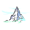
This popular trail follows a spectacular valley hemmed in by cliffs. All is easy to Ribbon Falls as the trail follows Ribbon Creek, unless you plan to continue to Ribbon Lake. Then it becomes more technical and difficult as cliff bands give rise to two spectacular waterfalls and cause difficulty and danger.
To have a better view of the falls, climb farther up the trail to a rocky
overlook, which is worth of this 8-km hike.
Description:
Number of Pictures: of