

Path
of the Glacier
 |
 |
 |
 |
 |
Location:
Jasper National Park
Date:
September 18, 2001
Distance:
1.6 kilometers
Maximum Elevation:
1786 meters
Elevation Gain:
30
meters
Time Required:
0.5
hours
Few walks in the Canadian Rockies offer such grandeur right from the parking lot. Even a leisurely stroll of a few hundred meters rewards with a panorama of Mount Edith Cavell.
The trail travels through a rocky glacial basin to a tiny but exquisite lake at the toe of the rubble-covered Cavell Glacier. The lake's dark blue waters are highlighted by drifting icebergs, and its shoreline is one of the best vantage points for the Angel Glacier and the towering cliffs of Mount Edith Cavell.
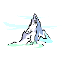
From the lakeshore, Mount Edith Cavell rises an incredible 1600 meters to the summit of the highest peak in this area of the park with the Angel Glacier clings to the wall.
Description:
Number of Pictures: of

